Our Geological Story
The Cross-Channel Geopark immerses us in a geological history spanning 400 million years. In the Devonian and Carboniferous periods, the region was emerging, forming a mountain range where life abounded, as evidenced by the fossils discovered in the Marquise Quarry Basin.
Over time, this range eroded, and during the Jurassic period, shallow marine environments took over, giving rise to stunning sandstone and clay cliffs, such as those at Cap Gris Nez, which attract more than two million visitors each year.
During the Cretaceous period, a greenhouse effect submerged Europe under the Chalk Sea, forming vast chalk hills. In the Geopark, these hills stretch from the edge of London to south of Boulogne-sur-Mer, only interrupted by the Channel, where they form the famous white cliffs of Dover and the Cap Blanc-Nez (this Chalk still connects us underneath the sea!). Composed of the shells of microscopic plankton (such as coccolithophores), chalk is the rock that connects our two regions and forms iconic features of the landscape, illustrating the deep connection between land and sea, as well as between two nations.
The Formation of the English Channel
One of the most significant events in the geological history of the Geopark took place about 450,000 years ago, towards the end of the Anglian Ice Age, a time when the Geopark was the coldest it has ever been. The Geopark area sat just south of the furthest point that the glaciers and ice sheet reached. A huge glacial lake had formed between the ice to the north, land masses to the east and west, and a ridge of chalk hills forming a dam to the south. The chalk hills acted as a land bridge that humans and animals could move across.
Eventually, the lake burst through the land bridge completely (as it did so it carved out 80m deep plunge pools in the solid rock that is now the seafloor!). This massive flood formed what we now know as the Channel, separating Britain and Europe. The submerged chalk ridge beneath the Channel is a reminder of this ancient land bridge, offering a unique geological link between the two coasts.
Geological Overview
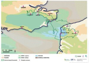
Cross-Channel Geopark Boundary
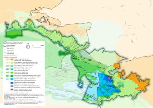
Devonian (419 – 359 million years ago)
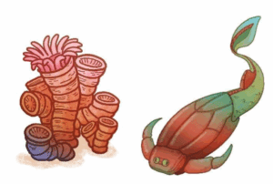
During the Devonian period, the territory of the Cross-Channel Geopark was underwater. The climate was tropical, favoring the development of large reef ecosystems. Fish, corals, mollusks, algae, and sponges coexisted in these reefs. Fossils preserved in limestone rocks on the French side of the Geopark testify to this rich marine life.
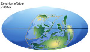
© F. Thirion after C. Scotese — Devonian
Carboniferous (359 – 299 million years ago)
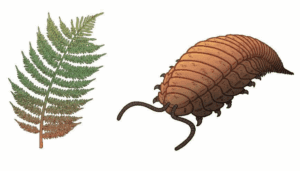
The climate remained tropical. During this period, the territory experienced major geological changes. Initially submerged, it gradually became part of a huge mountain-building event, forming a chain comparable to the modern Himalayas. By the end of the Carboniferous, these mountains were fully formed, and the land was no longer underwater.
At the foot of the mountains, vast swampy forests with lush vegetation thrived. These forests later formed coal deposits, exploited in areas like Marquise.
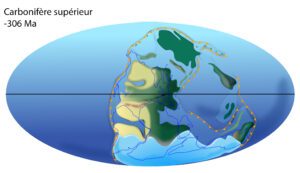
Paleogeographic map: © F. Thirion after C. Scotese — Carboniferous
Jurassic (199.5 – 145.5 million years ago)
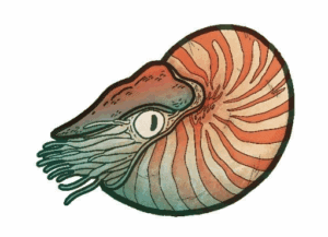
After the Carboniferous, the mountain chain was completely eroded, leaving the territory flat.
During the Jurassic, the land was periodically flooded by the sea. Rocks in the Boulonnais region (French side) contain limestone sandstones and clays rich in marine fossils, including ammonites, marine reptiles, fish, and bivalve mollusks.
These rocks reveal shallow marine environments, with traces of waves, tides, ripples, and sand dunes.
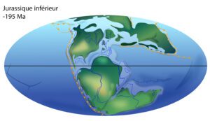
Paleogeographic map: © F. Thirion after C. Scotese — Jurassic
Cretaceous (145 – 65.5 million years ago)
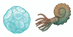
In the Early Cretaceous, a strong greenhouse effect raised global temperatures and sea levels. By the Late Cretaceous, much of Europe was covered by the “Chalk Sea.”
Marine life flourished, including mosasaurs, sharks, ammonites, and nautiluses, along with seabed organisms such as sponges, bivalves, and sea urchins. This period marks one of the richest phases of marine biodiversity in the region.
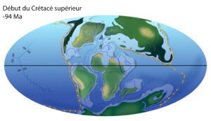
Paleogeographic map: © F. Thirion after C. Scotese — Cretaceous
Quaternary (Last 2.6 million years)
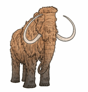
The Quaternary is the most recent epoch in Earth’s history and saw the appearance of the genus Homo.
It was a period of climatic instability, with alternating glacial (cold) and interglacial (warm) phases.
These climate changes shaped the landscapes of the Cross-Channel Geopark:
-
Formation of the Strait of Dover
-
Creation of coastal landscapes
-
Formation of river valleys and drainage systems
-
Settlement of humans in the region
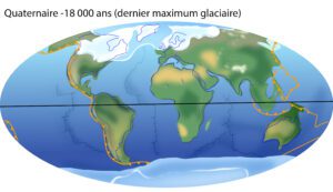
Paleogeographic map: © F. Thirion after C. Scotese — Quaternary
