Cycling through two countries, one shared landscape
August 5, 2026
Every path through the Cross-Channel Geopark Transmanche reveals a landscape with a story to tell. The white cliffs, chalk hills, rivers and woodlands we see today are part of a much older story, shaped over millions of years by ancient seas, geological change and the relationship between people and place.
Cycling is a wonderful way to experience this shared heritage. Quiet country lanes, traffic-free paths and scenic trails connect southern England and northern France through their geology, nature and history.
Every route offers a different way to experience the Cross-Channel Geopark Transmanche, whether you’re following the coast, climbing through chalk hills, winding through woodland or cycling alongside rivers and wetlands. Hop on your bike and discover the places, people and geology that connect two countries through one shared story.
Cross the Channel by bike on EuroVelo 5
EuroVelo 5 – Via Romea Francigena follows one of Europe’s historic pilgrimage routes. Within the Geopark, the route begins in Canterbury and crosses the chalky hills of the North Downs before reaching the White Cliffs of Dover. After crossing the English Channel by ferry, it reaches Calais and continues to Saint-Omer, passing through the varied coastal landscapes, the plains of the Calais region and the Audomarois marshes.
The journey highlights some striking connections between south-east England and northern France. The chalk cliffs of Dover mirror those of Cap Blanc-Nez, while the same geological formations continue beneath the English Channel. Natural habitats and heritage on both sides also reflect a shared history shaped over millions of years.
For cyclists, EuroVelo 5 offers a unique way to experience the Geopark, with the ferry crossing providing a welcome break before setting off to explore the landscapes on the opposite shore.
Chalk and Channel Way
For spectacular coastal views and a glimpse into the geology connecting England and France, start with the Chalk and Channel Way.
This 7-mile route follows the top of the White Cliffs between Dover and Folkestone, offering incredible views across the English Channel. These famous chalk cliffs were formed from the remains of tiny marine organisms living in warm seas millions of years ago, creating a geological story shared with the chalk landscapes of northern France.
Along the way, you’ll pass the Abbot’s Cliff sound mirror, a reminder of the more recent human history written into this landscape. Take care near cliff edges and follow local safety advice when exploring.
On clear days, you may be able to see France across the Channel, a powerful reminder that while the sea separates our countries today, geology connects them through deep time.
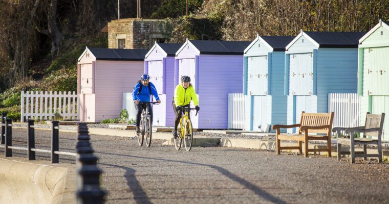
The route is accessible from Dover Priory and Folkestone Central stations, making it easy to explore sustainably by train and bike.
The Vélomaritime®: Calais to Boulogne-sur-Mer
To continue exploring the Geopark’s coastal areas, take the Vélomaritime® route between Calais and Boulogne-sur-Mer.
This linear route, approximately 51 km long, runs along the coastline, taking in a mix of sandy beaches, dunes, cliffs and unspoilt natural areas. Along the way, you’ll pass through Sangatte before reaching Cap Blanc-Nez, where, on a clear day, the panoramic view offers a breathtaking vista of the English Channel and the English coast.
The route also takes you through a mosaic of natural habitats, where dunes, limestone grasslands and cliffs are home to remarkable flora and fauna, including rare orchids, sea thrift, Fou du Bassan and Labbe pomarin. These places reflect the influence of wind, sea and human activity over the centuries, as well as the natural richness of the Geopark.
If travelling by train, the starting point is easily accessible from Calais-Ville and Calais-Fréthun stations, and the return journey can be made from Boulogne-Ville and Boulogne Tintelleries stations.
Great Stour Way
For a gentler ride, follow the River Stour through the countryside around Canterbury and Chartham.
Following the river for around 3 miles, this traffic-free route passes through meadows, marshes and woodland. The river is the main feature of the ride, with water playing an important role in the scenery and habitats along the way.
Look out for historic features including Milton Church and the remains of the former Elham Valley railway line, offering glimpses into how people have travelled through and shaped the area over generations.
With a mostly flat, surfaced path, it’s a great option for families and anyone wanting a relaxed way to enjoy the countryside.
The Hem Valley Loop
For a quieter ride through the heart of the Geopark’s rural areas, set off to explore the Hem Valley.
This loop, approximately 40 km long and starting in Tournehem-sur-le-Hem, follows peaceful roads through Licques, Zouafques and Audrehem. Along the way, the River Hem, limestone hillsides, hedgerow-lined meadows and rural villages reveal the character of the valley.
Traditional farms, old mills and stretches of farmland give the route a strong sense of place and offer a glimpse into the area’s natural and rural heritage.
North Downs Way Riders’ Route
For a longer adventure, the North Downs Way Riders’ Route takes you through some of the most iconic countryside in the Cross-Channel Geopark Transmanche.
Stretching between Farnham and Dover, this cycling route crosses the chalk landscapes of the North Downs, passing through woodland, farmland, villages and historic sites.
The chalk hills that define the North Downs were created millions of years ago beneath ancient seas. Today, they support rare habitats including chalk grasslands and ancient woodlands, such as those found in the North Kent Woods and Downs National Nature Reserve.
Along the route, cyclists can see the close relationship between geology, nature and people, with traditional farming landscapes, historic settlements and views that reveal the shape of the land beneath our feet.
Licques and Guînes Forest
To explore the wooded hills and agricultural areas of the Geopark’s interior, choose this route.
This loop starts in Licques before heading into the wooded hills of Guînes Forest. The route alternates between narrow country lanes, valleys, hedgerows and viewpoints overlooking the hills of the Haut-Pays.
The valleys and hillsides offer magnificent panoramic views, revealing the effects of geological movement, erosion and generations of farming.
The starting point is accessible from Pont d’Ardres railway station, about ten kilometres away, via a short cycle route.
Linking Coast and Downs
This circular route around Faversham brings together some of the varied scenery that makes our Geopark unique.
Starting in the historic market town of Faversham, the route travels through the famous Faversham Fruit Belt, where orchards, farmland and traditional countryside reflect centuries of interaction between people and the land.
The climb towards Perry Wood reveals another side of the area, with ancient woodland, panoramic views and a chance to see how hills and valleys have developed over geological time.
At the viewpoint known as The Pulpit, riders can look across the Vale of Kent and appreciate the wider connections that stretch across the Geopark.
The Cuvette
For a peaceful ride between woodland and wetlands, head to La Cuvette, a 17 km circular route starting at La Grange Nature in Clairmarais.
This gentle loop takes you through the Clairmarais Forest before reaching the marshes of the Audomarois. Along the way, you’ll pass close to the Romelaëre Nature Reserve, where former peat extraction has created a network of ponds that now provide an important habitat for wildlife.
Leaving the forest behind, the route passes through the village of Clairmarais, where boat trips offer another way to discover the Audomarois marshes, a UNESCO Biosphere Reserve.
With woodland, wetlands and traditional villages along the way, this route offers a relaxing introduction to one of the Geopark’s most distinctive environments.
Explore responsibly
When cycling through the Cross-Channel Geopark Transmanche:
- Stay on marked routes to protect wildlife, habitats and fragile landscapes
- Take litter home and help care for the places you visit
- Share paths with walkers, horse riders and other cyclists
- Check the weather and route conditions before setting off
- Wear a helmet and carry basic repair equipment
- Plan your route in advance and travel sustainably where possible
Popular articles
Explore the Cross-Channel Geopark with Our Geotouristic Map
Your guide to the Cross-Channel Geopark: download the free Geotouristic Map and…
The Best Viewpoints in the Cross-Channel Geopark
Discover the most spectacular viewpoints across the Cross-Channel Geopark, from the Kent…
Your guide to exploring the Cross-Channel Geopark with interpretation panels
Explore the Cross-Channel Geopark like never before with new interpretation panels that…